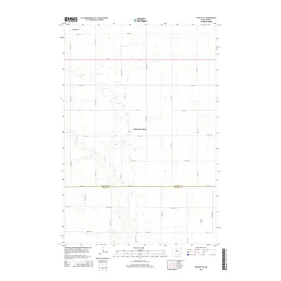
2014 Map of Edgeley SE
USGS Topo · Published 2014About this map
The agricultural landscape of the LaMoure and Dickey County line is defined by the meandering course of Maple River and its tributary, Maple Cr. This rural North Dakota terrain is sparsely settled, punctuated primarily by the Willowbank Colony and the small locality of Medberry in the northern reaches. The survey captures a moment in the region's communal and cultural history, most notably evidenced by the remote Finnish Cem located in the southeastern quadrant. A strict section-line road grid, including routes like 72nd St SE and 91st Ave SE, crisscrosses the prairie, providing access to the various wetlands and seasonal sloughs that dot the glaciated plain.
Find a feature on this map
22 named features on this map. Tap any name to fly to it.
Don’t see what you’re looking for? This feature index may not catch every label — zoom into the map to look around manually.
Map Details
Editions of this 2014 Edgeley SE Map
This is the sole edition of this map. No revisions or reprints were ever made.
Other maps of this area

1894 · Monango
USGS Topo · 1:62,500

1894 · La Moure
USGS Topo · 1:62,500

1894 · Fullerton
USGS Topo · 1:62,500

1895 · Lamoure
USGS Topo · 1:125,000

1896 · Edgeley
USGS Topo · 1:125,000

1918 · La Moure
USGS Topo · 1:125,000

1925 · Edgeley
USGS Topo · 1:125,000

1953 · Jamestown
USGS Topo · 1:250,000

1956 · Jamestown
USGS Topo · 1:250,000
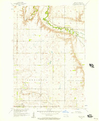
1956 · Berlin
USGS Topo · 1:24,000
Featured Places
- Porter Township, ND
- Valley Township, ND
- Badger Township, ND
- Willowbank Hutterite Colony, ND
- Wano Township, ND