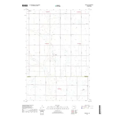
2017 Map of Edgeley SE
USGS Topo · Published 2017About this map
Maple River and its tributary Maple Cr meander through the prairie landscape of Dickey and LaMoure counties, following a winding path across the grid-patterned agricultural plains. This area is characterized by a high concentration of prairie potholes and wetlands that dot the sections between township roads. The small settlement of Medberry sits in the northwest, serving as a landmark for the rural community. Cultural and genealogical history is anchored by the presence of the Finnish Lutheran Cem in the southeast and the Willowbank Colony Cem further north. These sites, along with the systematically numbered section lines like 78th St SE, reflect the enduring settlement patterns of the North Dakota plains during the early twenty-first century.
Find a feature on this map
27 named features on this map. Tap any name to fly to it.
Don’t see what you’re looking for? This feature index may not catch every label — zoom into the map to look around manually.
Map Details
Editions of this 2017 Edgeley SE Map
This is the sole edition of this map. No revisions or reprints were ever made.
Other maps of this area

1894 · Monango
USGS Topo · 1:62,500

1894 · La Moure
USGS Topo · 1:62,500

1894 · Fullerton
USGS Topo · 1:62,500

1895 · Lamoure
USGS Topo · 1:125,000

1896 · Edgeley
USGS Topo · 1:125,000

1918 · La Moure
USGS Topo · 1:125,000

1925 · Edgeley
USGS Topo · 1:125,000

1953 · Jamestown
USGS Topo · 1:250,000

1956 · Jamestown
USGS Topo · 1:250,000
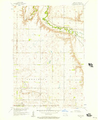
1956 · Berlin
USGS Topo · 1:24,000
Featured Places
- Porter Township, ND
- Valley Township, ND
- Badger Township, ND
- Willowbank Hutterite Colony, ND
- Wano Township, ND