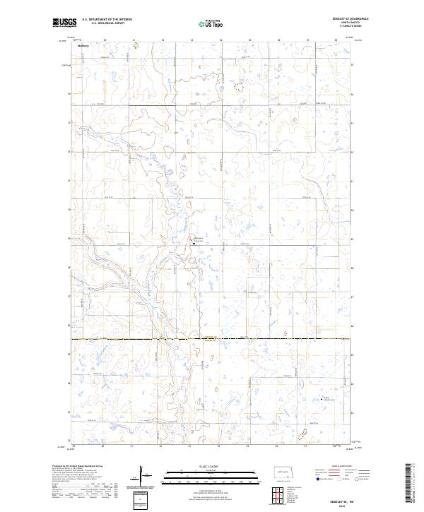
2024 Map of Edgeley SE
USGS Topo · Published 2024About this map
Maple Creek and the Maple River wind through the agricultural landscape along the LaMoure and Dickey County line. This modern survey illustrates the persistent section-line road network of the Great Plains, featuring routes such as 1st Ave and 72nd St SE. Evidence of the area's diverse cultural and religious history is visible in the placement of the Finnish Lutheran Cem in the southeastern corner and the Willowbank Colony Cem further north. While the small settlement of Medberry sits at the northern edge, the map is dominated by a complex system of prairie wetlands and intermittent ponds that characterize the drainage patterns of the James River Valley region.
Find a feature on this map
22 named features on this map. Tap any name to fly to it.
Don’t see what you’re looking for? This feature index may not catch every label — zoom into the map to look around manually.
Map Details
Editions of this 2024 Edgeley SE Map
This is the sole edition of this map. No revisions or reprints were ever made.
Other maps of this area

1894 · Monango
USGS Topo · 1:62,500

1894 · La Moure
USGS Topo · 1:62,500

1894 · Fullerton
USGS Topo · 1:62,500

1895 · Lamoure
USGS Topo · 1:125,000

1896 · Edgeley
USGS Topo · 1:125,000

1918 · La Moure
USGS Topo · 1:125,000

1925 · Edgeley
USGS Topo · 1:125,000

1953 · Jamestown
USGS Topo · 1:250,000

1956 · Jamestown
USGS Topo · 1:250,000
1956 · Berlin
USGS Topo · 1:24,000