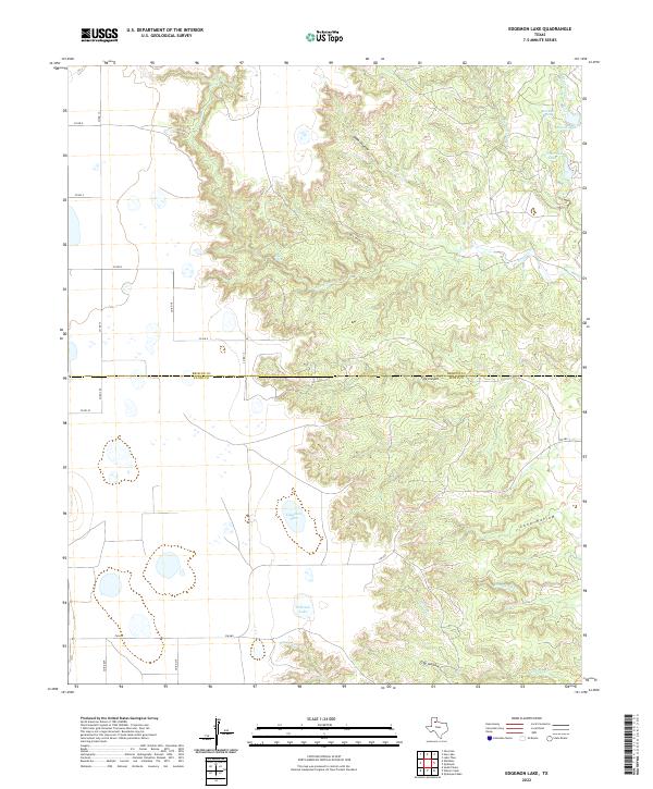
2022 Map of Edgemon Lake
USGS Topo · Published 2022About this map
Edgemon Lake and Emerson Lake sit at the heart of this landscape, marking a transition between the high plains and the complex drainage systems of the Caprock escarpment. The topography is defined by deep incisions such as Dark Canyon and Pole Canyon, which channel water toward the Los Lingos Cr system. This 2022 survey captures a remote section of the Texas Panhandle where the boundary between Briscoe and Floyd counties cuts through a series of dramatic landforms, including Dobbs Hollow and Long Hollow. These natural catchments and springs, like Red Rock Spring, have historically dictated the placement of ranch roads and water management in this arid environment. The map details a network of rural routes, including FM 689, that connect the isolated water bodies of Grahams Lake and Cottonwood Lake to the broader regional grid.
Find a feature on this map
28 named features on this map. Tap any name to fly to it.
Don’t see what you’re looking for? This feature index may not catch every label — zoom into the map to look around manually.
Map Details
Editions of this 2022 Edgemon Lake Map
This is the sole edition of this map. No revisions or reprints were ever made.
Other maps of this area

1954 · Plainview
USGS Topo · 1:250,000

1958 · Plainview
USGS Topo · 1:250,000

1965 · Whiteley
USGS Topo · 1:24,000

1965 · Silverton
USGS Topo · 1:24,000

1966 · South Plains
USGS Topo · 1:24,000

1967 · Quitaque
USGS Topo · 1:24,000

1967 · Quitaque Peaks
USGS Topo · 1:24,000

1967 · Edgemon Lake
USGS Topo · 1:24,000

1967 · Hay Lake
USGS Topo · 1:24,000
1967 · Wilson Creek
USGS Topo · 1:24,000