
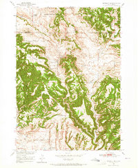
1950 Map of Edgemont NE
USGS Topo · Published 1952About this map
Harney National Forest dominates this mid-century landscape in the southern Black Hills, where rugged drainages like Red Canyon and Dudley Canyon carve through the terrain. The map records the ranching footprint of the era, identifying the Johnson Ranch, Robinson Ranch, and Fay Ranch as significant local landmarks. These family-run operations were supported by social infrastructure such as the Robinson Sch and White Draw Sch, which served the rural population of Fall River County.
Find a feature on this map
24 named features on this map. Tap any name to fly to it.
Don’t see what you’re looking for? This feature index may not catch every label — zoom into the map to look around manually.
Map Details
Editions of this 1950 Edgemont NE Map
Other maps of this area

1896 · Harney Peak
USGS Topo · 1:125,000

1901 · Harney Peak
USGS Topo · 1:125,000

1902 · Edgemont
USGS Topo · 1:125,000

1950 · Edgemont
USGS Topo · 1:24,000

1950 · Edgemont SW
USGS Topo · 1:24,000

1950 · Burdock
USGS Topo · 1:24,000

1950 · Minnekahta
USGS Topo · 1:24,000

1950 · Flint Hill
USGS Topo · 1:24,000

1954 · Jewel Cave SE
USGS Topo · 1:24,000
1954 · Jewel Cave SW
USGS Topo · 1:24,000