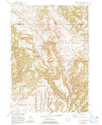
1950 Map of Edgemont NE
USGS Topo · Published 1992About this map
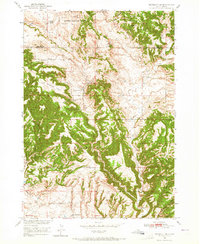
The Harney National Forest dominates this mid-century survey of the rugged Black Hills interface, where isolated homesteads and ranching outposts defined the local geography. Ranching life is documented through named sites like the Johnson Ranch, Robinson Ranch, and Hay Ranch, while the inclusion of the Robinson Sch and White Draw Sch highlights the distribution of small rural school districts across the Custer and Fall River County line. The topography is deeply incised by a network of drainages, including the prominent Red Canyon, Craven Canyon, and Stone Quarry Canyon. Evidence of early industrial and infrastructure efforts appears in the form of an abandoned oil well and the Burlington Dam, illustrating the persistent attempts to manage resources and water in this semi-arid landscape. The map provides a detailed look at the land use and settlement patterns before later modernization altered the area's rural character.
Find a feature on this map
26 named features on this map. Tap any name to fly to it.
Don’t see what you’re looking for? This feature index may not catch every label — zoom into the map to look around manually.
Map Details
Editions of this 1950 Edgemont NE Map
Other maps of this area

1896 · Harney Peak
USGS Topo · 1:125,000

1901 · Harney Peak
USGS Topo · 1:125,000

1902 · Edgemont
USGS Topo · 1:125,000

1950 · Edgemont
USGS Topo · 1:24,000

1950 · Edgemont SW
USGS Topo · 1:24,000

1950 · Burdock
USGS Topo · 1:24,000

1950 · Edgemont NE
USGS Topo · 1:24,000

1950 · Minnekahta
USGS Topo · 1:24,000

1950 · Flint Hill
USGS Topo · 1:24,000

1954 · Jewel Cave SE
USGS Topo · 1:24,000