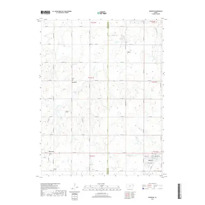
2018 Map of Edgerton
USGS Topo · Published 2018About this map
The borderlands of Douglas and Johnson Counties in eastern Kansas are defined by a grid of rural roads and the headwaters of numerous creeks, including Captain Cr and Wymore Cr. At the southern edge of the survey, the town of Edgerton is situated along the rail corridor, adjacent to Santa Fe Lake and South Lake. The landscape is dotted with small, historically significant settlements like Black Jack and Clearfield, each maintaining their own distinct community spaces. Genealogists will find a wealth of local burial sites such as Old Black Jack Cem, Pleasant Valley Cem, and Adams Cem. The map reveals a transition from the agricultural plateaus to the drainage basins of the Little Wakarusa Cr, illustrating the persistent rural character of the region as it borders more developed areas.
Find a feature on this map
60 named features on this map. Tap any name to fly to it.
Don’t see what you’re looking for? This feature index may not catch every label — zoom into the map to look around manually.
Map Details
Editions of this 2018 Edgerton Map
This is the sole edition of this map. No revisions or reprints were ever made.
Other maps of this area

1885 · Lawrence
USGS Topo · 1:125,000

1887 · Olathe
USGS Topo · 1:125,000

1889 · Lawrence
USGS Topo · 1:125,000

1893 · Olathe
USGS Topo · 1:125,000

1947 · Lawrence
USGS Topo · 1:250,000

1950 · Lawrence
USGS Topo · 1:250,000
1950 · Lawrence East
USGS Topo · 1:24,000

1951 · De Soto
USGS Topo · 1:24,000
1951 · Eudora
USGS Topo · 1:24,000

1956 · Wellsville
USGS Topo · 1:24,000