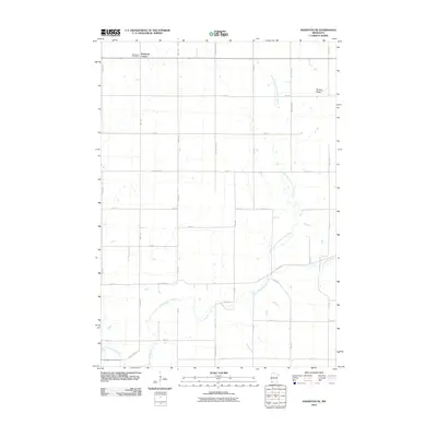
2010 Map of Edgerton NE
USGS Topo · Published 2010About this map
Buffalo Ridge rises as a prominent geographic feature in this corner of Pipestone County, defining the drainage patterns of the surrounding prairie. The landscape is deeply carved by the North Branch Chanarambie Creek and the main stem of Chanarambie Creek, which wind through a grid of agricultural section lines. These watercourses were vital to early settlement, providing drainage and water in an otherwise open upland environment. Near the northern border, the small settlement of Diamond Corner and the Woodstock Cemetery serve as focal points for local history and genealogy. The map illustrates a highly organized rural infrastructure, where a dense network of county roads like County Hwy-2 and numbered avenues facilitate the agricultural economy of southwestern Minnesota.
Find a feature on this map
31 named features on this map. Tap any name to fly to it.
Don’t see what you’re looking for? This feature index may not catch every label — zoom into the map to look around manually.
Map Details
Editions of this 2010 Edgerton NE Map
This is the sole edition of this map. No revisions or reprints were ever made.
Other maps of this area

1953 · Watertown
USGS Topo · 1:250,000

1953 · New Ulm
USGS Topo · 1:250,000

1954 · Fairmont
USGS Topo · 1:250,000

1955 · Sioux Falls
USGS Topo · 1:250,000

1957 · New Ulm
USGS Topo · 1:250,000

1958 · New Ulm
USGS Topo · 1:250,000

1958 · Sioux Falls
USGS Topo · 1:250,000

1958 · Fairmont
USGS Topo · 1:250,000

1958 · Watertown
USGS Topo · 1:250,000

1967 · New Ulm
USGS Topo · 1:250,000