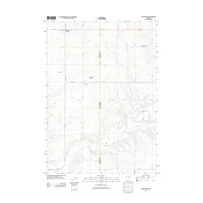
2013 Map of Edgerton NE
USGS Topo · Published 2013About this map
Buffalo Ridge dominates the eastern edge of this agricultural landscape, part of the broader Coteau des Prairies highland that divides major watersheds. The map reveals a strictly gridded rural environment where the Pipestone and Murray county lines meet along Co Line Ave. In the northwest corner, the intersection at Diamond Corner and the nearby Woodstock Cem serve as focal points for the surrounding farming community.
Find a feature on this map
35 named features on this map. Tap any name to fly to it.
Don’t see what you’re looking for? This feature index may not catch every label — zoom into the map to look around manually.
Map Details
Editions of this 2013 Edgerton NE Map
This is the sole edition of this map. No revisions or reprints were ever made.
Other maps of this area
1953 · Watertown
USGS Topo · 1:250,000
1953 · New Ulm
USGS Topo · 1:250,000
1954 · Fairmont
USGS Topo · 1:250,000
1955 · Sioux Falls
USGS Topo · 1:250,000
1957 · New Ulm
USGS Topo · 1:250,000
1958 · New Ulm
USGS Topo · 1:250,000
1958 · Sioux Falls
USGS Topo · 1:250,000
1958 · Fairmont
USGS Topo · 1:250,000
1958 · Watertown
USGS Topo · 1:250,000
1967 · New Ulm
USGS Topo · 1:250,000