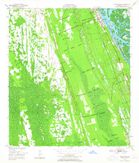
1950 Map of Edgewater
USGS Topo · Published 1964About this map
Historic Spanish and British land grants dominate the geography of this coastal Florida landscape, with large tracts like the Charles Sibbold Grant and Ambrose Hull Grant defining the early property boundaries south of New Smyrna Beach. The mid-century development of Edgewater is visible along the western shore of the Indian River North, where the Florida East Coast Line railroad runs parallel to the coast. Inland, the map reveals smaller settlements and family-named locations such as Massey Ranch, Hucomer, and Creighton. The terrain transitions from the tidal marshes of Pine Island Bay and the Three Sisters Islands to the interior wetlands drained by Little Cow Creek. A notable cemetery and Edgewater Junction provide specific points of interest for genealogists tracing the early 20th-century footprint of this Volusia County corridor.
Find a feature on this map
31 named features on this map. Tap any name to fly to it.
Don’t see what you’re looking for? This feature index may not catch every label — zoom into the map to look around manually.
Map Details
Editions of this 1950 Edgewater Map
5 editions found
Other maps of this area

1937 · Port Orange
USGS Topo · 1:48,000

1943 · Port Orange
USGS Topo · 1:62,500

1944 · Port Orange
USGS Topo · 1:62,500

1949 · Oak Hill
USGS Topo · 1:24,000

1949 · Osceola
USGS Topo · 1:24,000

1950 · Maytown
USGS Topo · 1:24,000

1950 · Ariel
USGS Topo · 1:24,000

1950 · Edgewater
USGS Topo · 1:24,000

1952 · Samsula
USGS Topo · 1:24,000

1954 · Daytona Beach
USGS Topo · 1:250,000