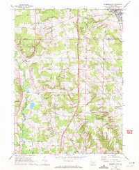
1968 Map of Edinboro South
USGS Topo · Published 1972About this map
Edinboro Lake and the southern outskirts of Edinboro anchor the northeastern corner of this Crawford County landscape, where the terrain transitions from the developed lakeshore to a pattern of woodlots and agriculture. The 1968 field check reveals a network of family-named roads like Florek Road and Stalecker Road that connect dispersed rural settlements and small local landmarks. Significant for genealogical research, the sheet identifies several remote burial grounds including Sherrod Hill Cem and the Garmel-Freeman Cem.
Find a feature on this map
54 named features on this map. Tap any name to fly to it.
Don’t see what you’re looking for? This feature index may not catch every label — zoom into the map to look around manually.
Map Details
Editions of this 1968 Edinboro South Map
3 editions found
Other maps of this area

1900 · Girard
USGS Topo · 1:62,500

1906 · Linesville
USGS Topo · 1:62,500

1908 · Linesville
USGS Topo · 1:62,500

1923 · Meadville
USGS Topo · 1:62,500

1923 · Cambridge Springs
USGS Topo · 1:62,500

1925 · Meadville
USGS Topo · 1:62,500

1925 · Cambridge Springs
USGS Topo · 1:62,500

1943 · Meadville
USGS Topo · 1:62,500

1943 · Cambridge Springs
USGS Topo · 1:62,500

1950 · Cleveland
USGS Topo · 1:250,000