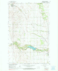
1963 Map of Edinburg
USGS Topo · Published 1990About this map
The Great Northern railroad tracks define the rural corridor through Walsh County, connecting the northern settlement of Edinburg with the southern hamlet of Kerry. This 1963 survey captures the landscape of the Red River Valley’s western edge, where the agricultural grid meets the meandering path of the South Branch Park River. Local landmarks such as the Garfield Ch and Calvary Cem serve as focal points for the surrounding farmsteads, while the Radio Tower and Landing Field indicate the mid-century infrastructure supporting this prairie community.
Find a feature on this map
30 named features on this map. Tap any name to fly to it.
Don’t see what you’re looking for? This feature index may not catch every label — zoom into the map to look around manually.
Map Details
Editions of this 1963 Edinburg Map
2 editions found
Other maps of this area

1944 · Crystal
USGS Topo · 1:62,500

1952 · Thief River Falls
USGS Topo · 1:250,000

1956 · Thief River Falls
USGS Topo · 1:250,000

1957 · Thief River Falls
USGS Topo · 1:250,000

1963 · Crystal
USGS Topo · 1:24,000

1963 · Edinburg
USGS Topo · 1:24,000

1963 · Pleasant Valley
USGS Topo · 1:24,000

1963 · Gardar
USGS Topo · 1:24,000

1963 · Pisek
USGS Topo · 1:24,000

1963 · Park River
USGS Topo · 1:24,000