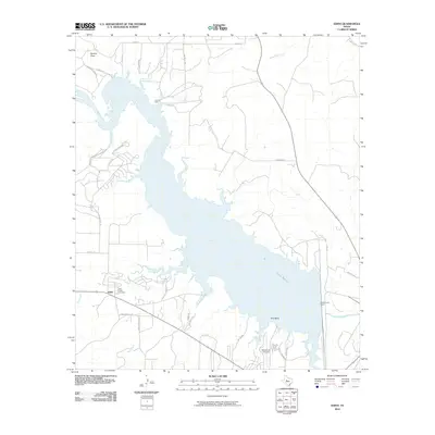
2010 Map of Edith
USGS Topo · Published 2010About this map
Lake Spence dominates the geography of this Coke County landscape, where the Colorado River was impounded to create a massive reservoir. The shoreline is punctuated by numerous inlets and small drainages including Salt Creek, Paint Creek, and Pecan Creek. To the west, the small settlement of Edith serves as a focal point near the Paint Creek Cemetery, offering a tangible link for genealogists studying the area's early residents.
Find a feature on this map
37 named features on this map. Tap any name to fly to it.
Don’t see what you’re looking for? This feature index may not catch every label — zoom into the map to look around manually.
Map Details
Editions of this 2010 Edith Map
This is the sole edition of this map. No revisions or reprints were ever made.
Other maps of this area

1891 · Hayrick
USGS Topo · 1:125,000

1893 · Sweetwater
USGS Topo · 1:125,000

1894 · Hayrick
USGS Topo · 1:125,000

1954 · Big Spring
USGS Topo · 1:250,000

1954 · San Angelo
USGS Topo · 1:250,000

1958 · San Angelo
USGS Topo · 1:250,000

1958 · Big Spring
USGS Topo · 1:250,000

1959 · Silver
USGS Topo · 1:24,000

1962 · Edith
USGS Topo · 1:24,000

1962 · Sanco
USGS Topo · 1:24,000