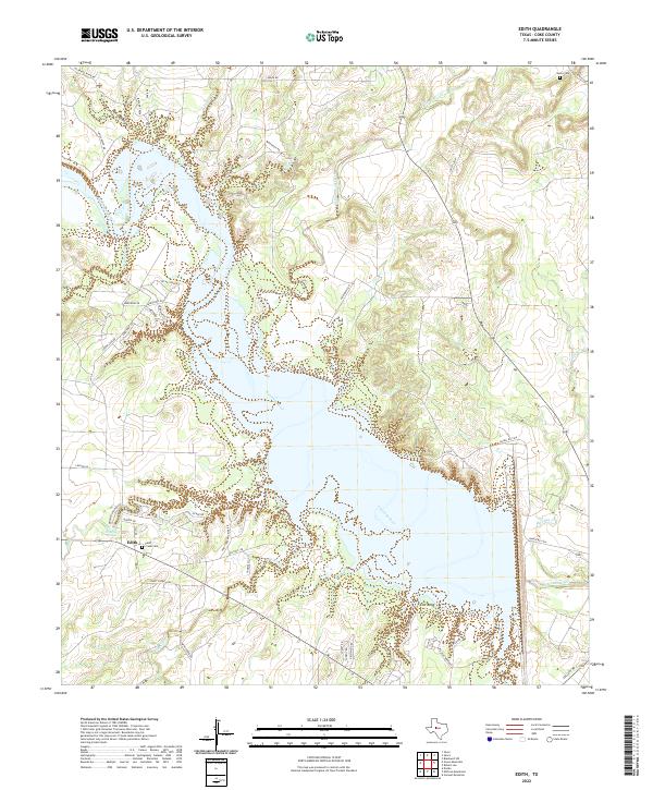
2022 Map of Edith
USGS Topo · Published 2022About this map
The Colorado River dominates this Coke County landscape, carving through the West Texas terrain and forming the central geographic feature of the region. Near the small settlement of Edith, the river is joined by several tributaries including Paint Creek and Pecan Creek, creating a network of drainage basins like Yellow Wolf Creek to the north and Messbox Cr to the east. The map reveals a transition from traditional ranching lands to contemporary lakeside development, evidenced by the dense network of residential roads such as Cedar Cove Rd and Sky Harbor Dr near the water's edge.
Find a feature on this map
46 named features on this map. Tap any name to fly to it.
Don’t see what you’re looking for? This feature index may not catch every label — zoom into the map to look around manually.
Map Details
Editions of this 2022 Edith Map
This is the sole edition of this map. No revisions or reprints were ever made.
Other maps of this area

1891 · Hayrick
USGS Topo · 1:125,000

1893 · Sweetwater
USGS Topo · 1:125,000

1894 · Hayrick
USGS Topo · 1:125,000

1954 · Big Spring
USGS Topo · 1:250,000

1954 · San Angelo
USGS Topo · 1:250,000

1958 · San Angelo
USGS Topo · 1:250,000

1958 · Big Spring
USGS Topo · 1:250,000

1959 · Silver
USGS Topo · 1:24,000

1962 · Edith
USGS Topo · 1:24,000

1962 · Sanco
USGS Topo · 1:24,000