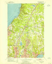
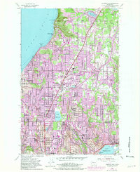
1953 Map of Edmonds East
USGS Topo · Published 1955About this map
Shoreline development along Puget Sound and Lake Washington defines this mid-century portrait of southern Snohomish County. The landscape is undergoing a rapid post-war transformation as suburban nodes like Mountlake Terrace and Lynnwood expand near the Pacific Highway. This growth is visible in the dense street grids emerging between established points like Edmonds and Alderwood Manor. Despite the residential push, the terrain remains deeply carved by features like Lunds Gulch and Swamp Creek, which dictate the winding paths of local roads and the remaining pockets of open space.
Find a feature on this map
60 named features on this map. Tap any name to fly to it.
Don’t see what you’re looking for? This feature index may not catch every label — zoom into the map to look around manually.
Map Details
Editions of this 1953 Edmonds East Map
5 editions found
Other maps of this area

1894 · Seattle
USGS Topo · 1:62,500

1895 · Snohomish
USGS Topo · 1:125,000

1897 · Seattle
USGS Topo · 1:125,000

1908 · Seattle
USGS Topo · 1:62,500

1909 · Seattle Special
USGS Topo · 1:62,500

1942 · Edmonds
USGS Topo · 1:62,500

1944 · Everett
USGS Topo · 1:62,500

1949 · Shilshole Bay
USGS Topo · 1:24,000

1949 · Seattle North
USGS Topo · 1:24,000

1950 · Kirkland
USGS Topo · 1:24,000