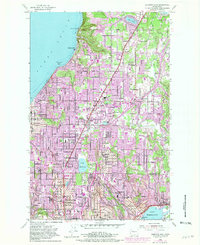
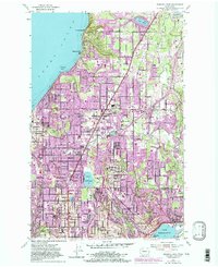
1953 Map of Edmonds East
USGS Topo · Published 1981About this map
The coastal bluffs of Puget Sound meet a rapidly diversifying landscape in this mid-century survey of south Snohomish County. The shoreline, anchored by Edmonds and Norma Beach, transitions into a terrain of deep ravines like Lunds Gulch and inland plateaus where the post-war suburban shift is clearly visible. The map documents the residential evolution of Mountlake Terrace and Lynnwood, contrasting these emerging centers with established nodes like Alderwood Manor. A heavy concentration of community infrastructure appears throughout, from the Kings Garden complex to specialized landmarks like the Kenmore Air Harbor on the tip of Lake Washington. Historical researchers can trace the early path of the Pacific Highway and the Great Northern railroad as they shaped the transit corridors between Seattle and the north. Notable burial sites, including the large Holyrood Cemetery and the Machzikay Hadath Cem, provide significant data points for genealogical study.
Find a feature on this map
65 named features on this map. Tap any name to fly to it.
Don’t see what you’re looking for? This feature index may not catch every label — zoom into the map to look around manually.
Map Details
Editions of this 1953 Edmonds East Map
5 editions found
Other maps of this area

1894 · Seattle
USGS Topo · 1:62,500

1895 · Snohomish
USGS Topo · 1:125,000

1897 · Seattle
USGS Topo · 1:125,000

1908 · Seattle
USGS Topo · 1:62,500

1909 · Seattle Special
USGS Topo · 1:62,500

1942 · Edmonds
USGS Topo · 1:62,500

1944 · Everett
USGS Topo · 1:62,500

1949 · Shilshole Bay
USGS Topo · 1:24,000

1949 · Seattle North
USGS Topo · 1:24,000

1950 · Kirkland
USGS Topo · 1:24,000