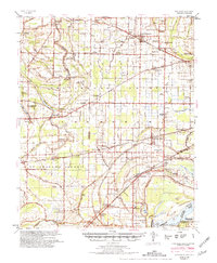
1954 Map of Edmondson
USGS Topo · Published 1981About this map
Edmondson and Crawfordsville anchor this mid-century landscape in eastern Arkansas, where the Mississippi River forms a natural boundary at Cow Island Bend. The terrain is defined by a dense network of drainage and transport, with the Chicago Rock Island and Pacific and Missouri Pacific railroads cutting through the Delta flatlands. The map reveals a high concentration of rural social centers, often combining education and faith, such as the New Shady Grove Sch, Ch & Cem and Pilgrim Rest Sch, Ch & Cem.
Find a feature on this map
138 named features on this map. Tap any name to fly to it.
Don’t see what you’re looking for? This feature index may not catch every label — zoom into the map to look around manually.
Map Details
Editions of this 1954 Edmondson Map
2 editions found

Other maps of this area

1908 · Lake Cormorant
USGS Topo · 1:24,000

1912 · Lake Cormorant
USGS Topo · 1:31,680

1916 · Memphis
USGS Topo · 1:62,500

1925 · Memphis
USGS Topo · 1:48,000

1927 · Memphis
USGS Topo · 1:62,500

1931 · Horseshoe Lake
USGS Topo · 1:62,500

1931 · Jericho
USGS Topo · 1:62,500

1932 · Horn Lake
USGS Topo · 1:48,000

1935 · Horn Lake
USGS Topo · 1:62,500

1939 · Horseshoe Lake
USGS Topo · 1:62,500