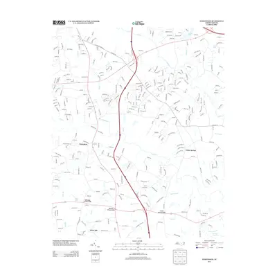
2013 Map of Edmondson
USGS Topo · Published 2013About this map
Edmondson and Willow Springs anchor this portion of the North Carolina piedmont, where the landscape is defined by the dendritic drainage patterns of Swift Cr and Middle Cr. The settlement pattern in this early 21st-century survey reveals a transition from traditional rural hubs like McGee Crossroads and Coats Crossroads to increasing suburban residential development. Local commerce and milling history are noted at McGee Mill, while the southern reaches of the map transition into the wetlands of Sassaraxa Swamp.
Find a feature on this map
272 named features on this map. Tap any name to fly to it.
Don’t see what you’re looking for? This feature index may not catch every label — zoom into the map to look around manually.
Map Details
Editions of this 2013 Edmondson Map
This is the sole edition of this map. No revisions or reprints were ever made.
Other maps of this area

1906 · Four Oaks
USGS Topo · 1:48,000

1908 · Four Oaks
USGS Topo · 1:62,500

1953 · Raleigh
USGS Topo · 1:250,000

1954 · Raleigh
USGS Topo · 1:250,000

1964 · Lake Wheeler
USGS Topo · 1:24,000

1964 · Garner
USGS Topo · 1:24,000

1964 · Selma
USGS Topo · 1:62,500

1964 · Angier
USGS Topo · 1:24,000

1964 · Clayton
USGS Topo · 1:24,000

1964 · Edmondson
USGS Topo · 1:24,000