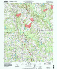
1993 Map of Edmondson
USGS Topo · Published 1999About this map
Middle Creek and Swift Creek wind through this Johnston County landscape, defining a rural region of North Carolina transitioning into a more developed road network in the 1990s. The area is anchored by historic community hubs such as Edmondson and McGee Crossroads, where the presence of the Cleveland Sch and various churches like Cleveland Ch and St Amandas Ch suggest long-established social centers. A dense concentration of family-named cemeteries, including Penny Cem, Walton Cem, and the Nimrod Stephenson Memorial Cem, provides significant genealogical value for those tracing local lineages.
Find a feature on this map
54 named features on this map. Tap any name to fly to it.
Don’t see what you’re looking for? This feature index may not catch every label — zoom into the map to look around manually.
Map Details
Editions of this 1993 Edmondson Map
This is the sole edition of this map. No revisions or reprints were ever made.
Other maps of this area

1906 · Four Oaks
USGS Topo · 1:48,000

1908 · Four Oaks
USGS Topo · 1:62,500

1953 · Raleigh
USGS Topo · 1:250,000

1954 · Raleigh
USGS Topo · 1:250,000

1964 · Lake Wheeler
USGS Topo · 1:24,000

1964 · Garner
USGS Topo · 1:24,000

1964 · Selma
USGS Topo · 1:62,500

1964 · Angier
USGS Topo · 1:24,000

1964 · Clayton
USGS Topo · 1:24,000

1964 · Edmondson
USGS Topo · 1:24,000