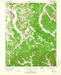
1953 Map of Edmonton
USGS Topo · Published 1966About this map
Edmonton serves as the focal point of this Kentucky landscape, situated along the South Fork Little Barren River during the early 1950s. The map illustrates a rural society deeply rooted in its geography, with numerous country schools like Hickory Ridge Sch and Moccasin Sch and small churches such as Wintrey Chapel and Beech Grove Ch serving dispersed communities. The terrain is defined by prominent ridges including Silas Barnes Ridge and Biel Ridge, which dictate the winding paths of local roads and the placement of family farmsteads.
Find a feature on this map
64 named features on this map. Tap any name to fly to it.
Don’t see what you’re looking for? This feature index may not catch every label — zoom into the map to look around manually.
Map Details
Editions of this 1953 Edmonton Map
2 editions found
Other maps of this area

1953 · Gradyville
USGS Topo · 1:24,000

1953 · Sulphur Well
USGS Topo · 1:24,000

1953 · Sulphur Lick
USGS Topo · 1:24,000

1953 · Breeding
USGS Topo · 1:24,000

1953 · Waterview
USGS Topo · 1:24,000

1953 · Edmonton
USGS Topo · 1:24,000

1953 · Summer Shade
USGS Topo · 1:24,000

1953 · Dubre
USGS Topo · 1:24,000

1953 · East Fork
USGS Topo · 1:24,000

1956 · Corbin
USGS Topo · 1:250,000