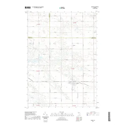
2019 Map of Edmore
USGS Topo · Published 2019About this map
Edmore serves as a local hub in this Montcalm County landscape, where the street grid intersects with the Fred Meijer Heartland Trail. To the north, the small settlement of Wyman is situated along Co Rd 550, surrounded by a complex network of wetlands and small water bodies including Kirby Lake and Mud Lake. The western portion of the map is characterized by a distinctive chain of lakes, specifically Fourth Lake, Fifth Lake, and Sixth Lake, which feed into Black Cr. Genealogy researchers will find significant landmarks such as Vinewood Cem on the southern edge of the village and Home Cem located to the northeast. This 2019 survey documents a landscape defined by its transition from organized town blocks to a sprawling system of rural roads and glacial lake features.
Find a feature on this map
59 named features on this map. Tap any name to fly to it.
Don’t see what you’re looking for? This feature index may not catch every label — zoom into the map to look around manually.
Map Details
Editions of this 2019 Edmore Map
This is the sole edition of this map. No revisions or reprints were ever made.
Other maps of this area

1916 · Mount Pleasant
USGS Topo · 1:62,500

1919 · Mount Pleasant
USGS Topo · 1:62,500

1943 · Mount Pleasant
USGS Topo · 1:62,500

1954 · Midland
USGS Topo · 1:250,000

1958 · Midland
USGS Topo · 1:250,000

1959 · Midland
USGS Topo · 1:250,000

1964 · Edmore
USGS Topo · 1:24,000

1964 · Six Lakes
USGS Topo · 1:24,000

1964 · Blanchard
USGS Topo · 1:24,000

1964 · Langston
USGS Topo · 1:24,000