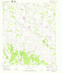
1956 Map of Edna Hill
USGS Topo · Published 1979About this map
The boundary between Erath County and Comanche County bisects this ranching and agricultural landscape in central Texas. Small rural communities like Edna Hill and Wilson serve as focal points for the surrounding farmsteads, connected by a network of unimproved roads and light-duty tracks. The area is defined by its drainage systems, with Resley Creek and its many tributaries, including Long Branch and Salt Branch, carving through the terrain. In the southern portion of the map, the headwaters of Joplin Creek and Wet Joplin Creek emerge near the settlement of Hazeldell.
Find a feature on this map
17 named features on this map. Tap any name to fly to it.
Don’t see what you’re looking for? This feature index may not catch every label — zoom into the map to look around manually.
Map Details
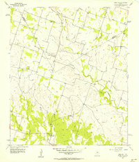
Editions of this 1956 Edna Hill Map
2 editions found
Other maps of this area

1888 · Hamilton
USGS Topo · 1:125,000

1890 · Stephenville
USGS Topo · 1:125,000

1894 · Hamilton
USGS Topo · 1:125,000

1920 · Stephenville
USGS Topo · 1:125,000

1954 · Brownwood
USGS Topo · 1:250,000

1954 · Abilene
USGS Topo · 1:250,000

1956 · Gustine
USGS Topo · 1:62,500

1956 · Gentrys Mill
USGS Topo · 1:24,000

1956 · Gustine
USGS Topo · 1:24,000

1956 · Hico
USGS Topo · 1:62,500