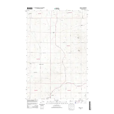
2014 Map of Edwall
USGS Topo · Published 2014About this map
Edwall anchors the southern portion of this landscape, situated where Wa-231 intersects the local road network. The terrain is defined by the winding course of Crab Cr and the presence of significant high points such as Hanning Butte and Magnison Butte. This region in Lincoln County shows a transition from the agricultural flats near Wheeler Corner to the more varied topography of Pleasant Valley. A network of rural routes, including Cloverdale Rd E and Bluestem Rd E, connects several small settlements and landmarks. Genealogists and local historians will find the Pleasant Valley Cem a significant point of interest, while other named locations like Elanor and Gravelles reveal the distribution of the population across the township and range divisions. The map also identifies water sources like Joes Spring, which are vital in this relatively arid environment.
Find a feature on this map
43 named features on this map. Tap any name to fly to it.
Don’t see what you’re looking for? This feature index may not catch every label — zoom into the map to look around manually.
Map Details
Editions of this 2014 Edwall Map
This is the sole edition of this map. No revisions or reprints were ever made.
Other maps of this area

1945 · Reardan
USGS Topo · 1:62,500

1953 · Reardan
USGS Topo · 1:62,500

1953 · Ritzville
USGS Topo · 1:250,000

1954 · Sprague
USGS Topo · 1:62,500

1955 · Spokane
USGS Topo · 1:250,000

1958 · Spokane
USGS Topo · 1:250,000

1959 · Ritzville
USGS Topo · 1:250,000

1965 · Ritzville
USGS Topo · 1:250,000
1969 · Mondovi
USGS Topo · 1:24,000

1969 · Omans
USGS Topo · 1:24,000