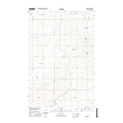
2017 Map of Edwall
USGS Topo · Published 2017About this map
Edwall serves as a central hub for this Lincoln County landscape, where the agricultural grid meets the natural winding course of Crab Cr. The terrain is punctuated by distinctive high points such as Hanning Butte and Magnison Butte, which break the pattern of the surrounding wheat country and pasture lands. This 2017 survey documents several small settlements and localities, including the residential clusters at Elanor and Gravelles.
Find a feature on this map
42 named features on this map. Tap any name to fly to it.
Don’t see what you’re looking for? This feature index may not catch every label — zoom into the map to look around manually.
Map Details
Editions of this 2017 Edwall Map
This is the sole edition of this map. No revisions or reprints were ever made.
Other maps of this area

1945 · Reardan
USGS Topo · 1:62,500

1953 · Reardan
USGS Topo · 1:62,500

1953 · Ritzville
USGS Topo · 1:250,000

1954 · Sprague
USGS Topo · 1:62,500

1955 · Spokane
USGS Topo · 1:250,000

1958 · Spokane
USGS Topo · 1:250,000

1959 · Ritzville
USGS Topo · 1:250,000

1965 · Ritzville
USGS Topo · 1:250,000
1969 · Mondovi
USGS Topo · 1:24,000

1969 · Omans
USGS Topo · 1:24,000