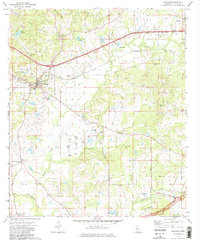
1972 Map of Edwards
USGS Topo · Published 1984About this map
Edwards serves as the primary hub of activity in this part of Hinds County, situated along the Illinois Central Gulf railroad. The landscape is characterized by a dense network of spiritual and community landmarks, particularly evident in the high concentration of rural churches like Champion Hill Ch and Mt Shiloh Ch. These sites, often paired with family-named grounds like Ratliff Chapel Cem, provide essential anchor points for genealogists tracing family roots in central Mississippi.
Find a feature on this map
41 named features on this map. Tap any name to fly to it.
Don’t see what you’re looking for? This feature index may not catch every label — zoom into the map to look around manually.
Map Details
Editions of this 1972 Edwards Map
3 editions found
Other maps of this area

1903 · Jackson
USGS Topo · 1:125,000

1934 · Raymond
USGS Topo · 1:48,000

1937 · Raymond
USGS Topo · 1:62,500

1937 · Terry
USGS Topo · 1:48,000

1938 · Edwards
USGS Topo · 1:62,500

1942 · Raymond
USGS Topo · 1:62,500

1943 · Terry
USGS Topo · 1:62,500

1955 · Jackson
USGS Topo · 1:250,000

1961 · Jackson
USGS Topo · 1:250,000

1962 · Jackson
USGS Topo · 1:250,000