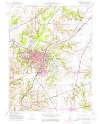
1954 Map of Edwardsville
USGS Topo · Published 1975About this map
Edwardsville is depicted here as a robust regional hub during a period of significant growth and institutional expansion. The map captures the developing Southern Illinois University (Edwardsville Campus) southwest of the city center, marking a shift from the area's agricultural roots toward its future as a major educational center. The landscape is defined by a dense web of transportation, where lines from the Illinois Terminal, Chicago and North Western, and Gulf Mobile and Ohio railroads converge at points like Bluff Junction. To the east, Dunlap Lake provides a notable residential and recreational water feature, while peripheral settlements such as Le Claire and Glen Carbon show the early footprints of suburban development. Rural identity remains strong in the outlying townships of Fort Russell and Pin Oak, evidenced by family-named landmarks like Burkett Cem and community pillars like Quercus Grove Ch.
Find a feature on this map
43 named features on this map. Tap any name to fly to it.
Don’t see what you’re looking for? This feature index may not catch every label — zoom into the map to look around manually.
Map Details
Editions of this 1954 Edwardsville Map
4 editions found
Other maps of this area

1888 · St. Louis
USGS Topo · 1:62,500

1907 · Belleville
USGS Topo · 1:62,500

1927 · Alton
USGS Topo · 1:62,500

1927 · Edwardsville
USGS Topo · 1:62,500

1932 · Edwardsville
USGS Topo · 1:62,500

1934 · Alton
USGS Topo · 1:62,500

1935 · Monks Mound
USGS Topo · 1:24,000

1937 · Collinsville
USGS Topo · 1:24,000

1948 · Wood River
USGS Topo · 1:24,000

1949 · Saint Louis
USGS Topo · 1:250,000