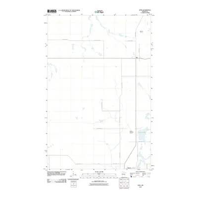
2010 Map of Effie
USGS Topo · Published 2010About this map
Effie and Bigfork represent the primary points of settlement in this northern Minnesota landscape as of 2010. The terrain is characterized by a winding network of waterways, most notably the Big Fork River and its various tributaries like Bowerman Brook and Plum Creek. This geography has historically dictated the placement of roads and homesteads in Itasca County. Local infrastructure is anchored by the Bigfork Municipal Airport and a grid of county highways, including County Hwy-259 and County Hwy-226. For those researching local heritage, the North Star Cemetery stands near the northern edge of the survey, while Connors Lake remains a prominent natural landmark in the southeastern portion of the quadrangle. The map reflects a rural community where modern transportation routes like River Rd follow the ancient path of the river valley.
Find a feature on this map
20 named features on this map. Tap any name to fly to it.
Don’t see what you’re looking for? This feature index may not catch every label — zoom into the map to look around manually.
Map Details
Editions of this 2010 Effie Map
This is the sole edition of this map. No revisions or reprints were ever made.
Other maps of this area

1918 · Zora
USGS Topo · 1:62,500

1919 · Zora
USGS Topo · 1:62,500

1919 · Marcell
USGS Topo · 1:62,500

1954 · Hibbing
USGS Topo · 1:250,000

1957 · Hibbing
USGS Topo · 1:250,000

1958 · Hibbing
USGS Topo · 1:250,000

1964 · Hibbing
USGS Topo · 1:250,000

1970 · Coon Lake
USGS Topo · 1:24,000
1970 · Spring Lake
USGS Topo · 1:24,000
1970 · Bigfork
USGS Topo · 1:24,000