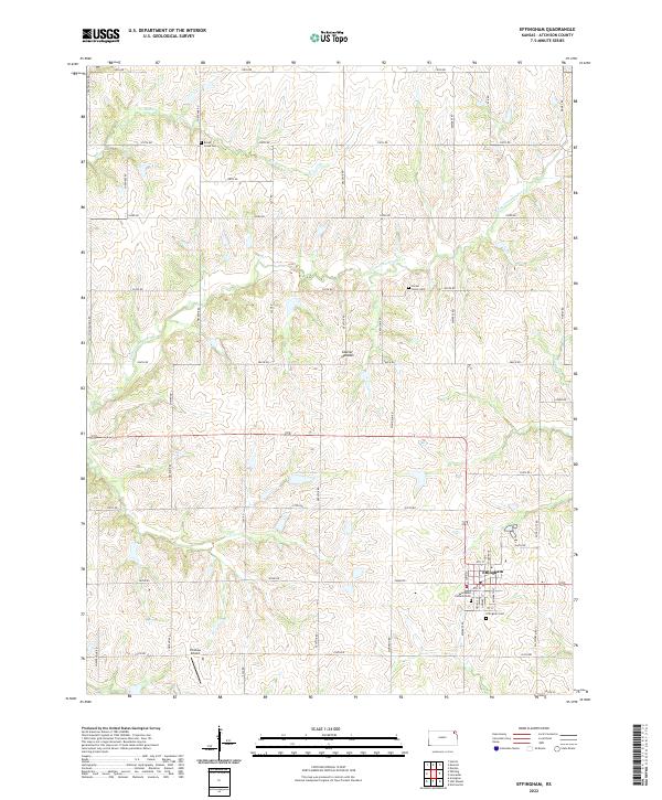
2022 Map of Effingham
USGS Topo · Published 2022About this map
Effingham serves as the central hub of this agricultural landscape in Atchison County, characterized by the undulating terrain of the Glacier Uplands. The town's grid is clearly defined, with Saint Anns Catholic Cem and the Effingham Cem located on its southern outskirts. The surrounding countryside is marked by a network of sectional roads and the drainage patterns of Little Grasshopper Cr and Brush Cr, which carve through the till plains. Local aviation history is represented by the Strafuss Airport to the southwest, while the presence of the Brush Creek Cem and Forest Grove Cem provides specific points of interest for those tracing family lineages in the rural townships. Figge Lake offers a rare larger body of water amidst the creek-fed valleys of Stranger Cr and its tributaries, illustrating the modern management of the local watershed.
Find a feature on this map
46 named features on this map. Tap any name to fly to it.
Don’t see what you’re looking for? This feature index may not catch every label — zoom into the map to look around manually.
Map Details
Editions of this 2022 Effingham Map
This is the sole edition of this map. No revisions or reprints were ever made.
Other maps of this area

1885 · Atchison
USGS Topo · 1:125,000

1886 · Oskaloosa
USGS Topo · 1:125,000

1888 · Oskaloosa
USGS Topo · 1:125,000

1888 · Atchison
USGS Topo · 1:125,000

1888 · Hiawatha
USGS Topo · 1:125,000

1889 · Topeka
USGS Topo · 1:125,000

1893 · Atchison
USGS Topo · 1:125,000

1894 · Oskaloosa
USGS Topo · 1:125,000

1894 · Topeka
USGS Topo · 1:125,000

1894 · Hiawatha
USGS Topo · 1:125,000