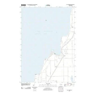
2010 Map of Egg Harbor
USGS Topo · Published 2010About this map
Green Bay and the shoreline of Lake Michigan define this section of the Door County peninsula. The village of Egg Harbor serves as the primary hub, where the residential and commercial streets meet the water. Inland, the landscape is organized by a network of county highways and local roads such as Cottage Row and Gibraltar Bluff Rd, reflecting the area's development as a settled agricultural and residential corridor. Genealogy researchers will find several well-defined burial grounds, including Egg Harbor Cemetery, Juddville Cemetery, and Saint Johns Cemetery, which anchor the local history of these coastal communities. Notable coastal landmarks like Leroys Point and Horseshoe Point punctuate the jagged western edge of the peninsula, while Hat Island sits isolated in the bay. Tucked away from the coast, Lost Lake provides a distinct geographical contrast to the expansive waters of the Great Lakes nearby.
Find a feature on this map
34 named features on this map. Tap any name to fly to it.
Don’t see what you’re looking for? This feature index may not catch every label — zoom into the map to look around manually.
Map Details
Editions of this 2010 Egg Harbor Map
This is the sole edition of this map. No revisions or reprints were ever made.
Other maps of this area

1954 · Escanaba
USGS Topo · 1:250,000

1954 · Manitowoc
USGS Topo · 1:250,000

1957 · Escanaba
USGS Topo · 1:250,000

1958 · Escanaba
USGS Topo · 1:250,000

1958 · Manitowoc
USGS Topo · 1:250,000

1960 · Sturgeon Bay
USGS Topo · 1:62,500

1960 · Jacksonport
USGS Topo · 1:62,500

1960 · Sister Bay
USGS Topo · 1:62,500

1961 · Chambers Island
USGS Topo · 1:62,500

1981 · Institute
USGS Topo · 1:24,000