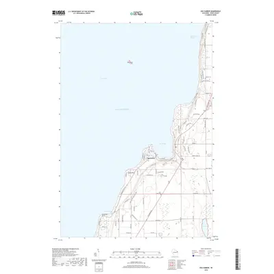
2018 Map of Egg Harbor
USGS Topo · Published 2018About this map
Egg Harbor serves as the central hub of this Door County coastal survey, where the village is framed by the waters of Green Bay and Lake Michigan. The landscape is defined by its dramatic shoreline, from the northern reach of Strawberry Channel past Juddville Bay to the southern curve of Horseshoe Bay. Inland, the map reveals a community structured around its history and natural landmarks, including several burial grounds such as Saint Johns Cem and Juddville Cem.
Find a feature on this map
72 named features on this map. Tap any name to fly to it.
Don’t see what you’re looking for? This feature index may not catch every label — zoom into the map to look around manually.
Map Details
Editions of this 2018 Egg Harbor Map
This is the sole edition of this map. No revisions or reprints were ever made.
Other maps of this area

1954 · Escanaba
USGS Topo · 1:250,000

1954 · Manitowoc
USGS Topo · 1:250,000

1957 · Escanaba
USGS Topo · 1:250,000

1958 · Escanaba
USGS Topo · 1:250,000

1958 · Manitowoc
USGS Topo · 1:250,000

1960 · Sturgeon Bay
USGS Topo · 1:62,500

1960 · Jacksonport
USGS Topo · 1:62,500

1960 · Sister Bay
USGS Topo · 1:62,500

1961 · Chambers Island
USGS Topo · 1:62,500

1981 · Institute
USGS Topo · 1:24,000