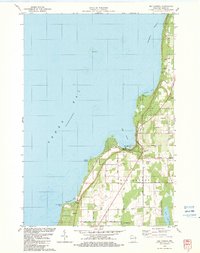
1982 Map of Egg Harbor
USGS Topo · Published 1983About this map
Green Bay and the sheltered waters of Strawberry Channel define this coastal portion of Door County in the early 1980s. The landscape is a mix of agricultural plots and burgeoning leisure development, anchored by the village of Egg Harbor. Significant landmarks like the Alpine Country Club and Murphy County Park reflect the area's identity as a recreational destination. Along the shoreline, prominent features such as Horseshoe Point and Leroys Point punctuate the jagged coast, while the upland areas of Gibraltar rise above the harbor.
Find a feature on this map
40 named features on this map. Tap any name to fly to it.
Don’t see what you’re looking for? This feature index may not catch every label — zoom into the map to look around manually.
Map Details
Editions of this 1982 Egg Harbor Map
This is the sole edition of this map. No revisions or reprints were ever made.
Other maps of this area

1954 · Escanaba
USGS Topo · 1:250,000

1954 · Manitowoc
USGS Topo · 1:250,000

1957 · Escanaba
USGS Topo · 1:250,000

1958 · Escanaba
USGS Topo · 1:250,000

1958 · Manitowoc
USGS Topo · 1:250,000

1960 · Sturgeon Bay
USGS Topo · 1:62,500

1960 · Jacksonport
USGS Topo · 1:62,500

1960 · Sister Bay
USGS Topo · 1:62,500

1961 · Chambers Island
USGS Topo · 1:62,500

1981 · Institute
USGS Topo · 1:24,000