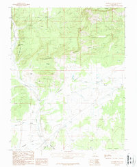
1987 Map of Eightmile Pass
USGS Topo · Published 1987About this map
The Vermilion Cliffs dominate this 1987 survey of Kane County, Utah, providing a distinct geographic boundary between the high plateau country and the lower-lying Kimball Valley. This arid landscape is characterized by its drainage systems and vertical relief, where cattle ranching and sparse industrial activity are marked by the presence of the King Mine and a Gravel Pit. Important water sources in this dry environment include Kitchen Corral Spring and the Aqueduct that cuts across the valley floor.
Find a feature on this map
19 named features on this map. Tap any name to fly to it.
Don’t see what you’re looking for? This feature index may not catch every label — zoom into the map to look around manually.
Map Details
Editions of this 1987 Eightmile Pass Map
This is the sole edition of this map. No revisions or reprints were ever made.
Other maps of this area

1886 · Kanab
USGS Topo · 1:250,000

1886 · Escalante
USGS Topo · 1:250,000

1953 · Cedar City
USGS Topo · 1:250,000

1954 · Buckskin Gulch NW
USGS Topo · 1:24,000

1954 · Buckskin Gulch NE
USGS Topo · 1:24,000

1954 · Buckskin Gulch SE
USGS Topo · 1:24,000

1954 · Buckskin Gulch SW
USGS Topo · 1:24,000

1954 · Paria NW
USGS Topo · 1:24,000
1954 · Paria SW
USGS Topo · 1:24,000

1954 · Buckskin Gulch
USGS Topo · 1:62,500