
1954 Map of Ekalaka
USGS Topo · Published 1966About this map
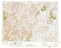
Custer National Forest anchors this mid-century survey of Southeast Montana, where the High Plains transition into the breaks of the Powder River. The map captures a landscape defined by isolated ranching communities and a network of rural schoolhouses, many of which served as the social centers for remote townships. Named schools such as the Sherwin School, Peabody School, and Kingsley School are scattered across the terrain, illustrating the era's decentralized education system before the consolidation of rural districts.
Find a feature on this map
107 named features on this map. Tap any name to fly to it.
Don’t see what you’re looking for? This feature index may not catch every label — zoom into the map to look around manually.
Map Details
Editions of this 1954 Ekalaka Map
3 editions found
Other maps of this area

1901 · Aladdin
USGS Topo · 1:125,000

1903 · Aladdin
USGS Topo · 1:125,000

1905 · Devils Tower
USGS Topo · 1:125,000

1905 · Indian
USGS Topo · 1:62,500

1907 · Belle Fourche
USGS Topo · 1:125,000

1935 · Harding
USGS Topo · 1:125,000

1935 · Buffalo
USGS Topo · 1:125,000

1953 · Rapid City
USGS Topo · 1:250,000

1953 · Miles City
USGS Topo · 1:250,000

1953 · Dickinson
USGS Topo · 1:250,000