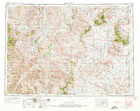
1954 Map of Ekalaka
USGS Topo · Published 1973About this map
Custer National Forest dominates the high ground of the Montana-Wyoming borderlands, where the Powder River and Mizpah Creek systems carve a network of drainages through the plains. This mid-century landscape is defined by its wide-ranging rural infrastructure, marked by numerous isolated schoolhouses that served a dispersed ranching community. Educational landmarks like the Sherwin School, Peabody School, and Mizpah School appear alongside small settlements such as Alzada, Albion, and Capitol. The map details a complex system of named coulees and creeks, including Boxelder Creek and Pumpkin Creek, that dictated the placement of early homesteads and travel routes across the high plains. Prominent landforms like Sheep Mountain and the Humboldt Hills rise above the drainage basins, providing crucial orientation points in a territory where state lines meet at the intersection of Montana, Wyoming, and the Dakotas.
Find a feature on this map
112 named features on this map. Tap any name to fly to it.
Don’t see what you’re looking for? This feature index may not catch every label — zoom into the map to look around manually.
Map Details
Editions of this 1954 Ekalaka Map
3 editions found

Other maps of this area

1901 · Aladdin
USGS Topo · 1:125,000

1903 · Aladdin
USGS Topo · 1:125,000

1905 · Devils Tower
USGS Topo · 1:125,000

1905 · Indian
USGS Topo · 1:62,500

1907 · Belle Fourche
USGS Topo · 1:125,000

1935 · Harding
USGS Topo · 1:125,000

1935 · Buffalo
USGS Topo · 1:125,000

1953 · Rapid City
USGS Topo · 1:250,000

1953 · Miles City
USGS Topo · 1:250,000

1953 · Dickinson
USGS Topo · 1:250,000