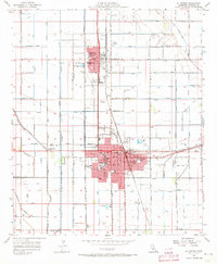
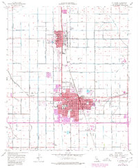
1957 Map of El Centro
USGS Topo · Published 1973About this map
Imperial and El Centro define the heart of the Imperial Valley in this mid-century portrait, revealing an engineered landscape where irrigation is king. The map documents an intricate network of water infrastructure, including the Lotus Canal, Dahlia Canal, and dozens of laterals like Date Lateral 10 and Eucalyptus Lateral 17 that sustain the desert agriculture. The urban centers are densely packed with civic and educational landmarks, from the Court House and Imperial Valley College to numerous neighborhood schools like Harding Sch and Wright Sch.
Find a feature on this map
82 named features on this map. Tap any name to fly to it.
Don’t see what you’re looking for? This feature index may not catch every label — zoom into the map to look around manually.
Map Details
Editions of this 1957 El Centro Map
5 editions found
Other maps of this area

1907 · Holtville
USGS Topo · 1:125,000

1915 · El Centro
USGS Topo · 1:125,000

1940 · Brawley
USGS Topo · 1:62,500

1940 · Heber
USGS Topo · 1:62,500

1940 · Alamorio
USGS Topo · 1:62,500

1940 · Calexico
USGS Topo · 1:62,500

1942 · El Centro
USGS Topo · 1:250,000

1943 · Heber
USGS Topo · 1:62,500

1943 · Brawley
USGS Topo · 1:62,500

1943 · Calexico
USGS Topo · 1:62,500