
1953 Map of El Dorado
USGS Topo · Published 1967About this map
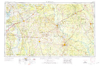
The Ouachita River and Saline River systems dominate this mid-century portrait of South Arkansas, where the region’s economic transition from timber to industrial energy is clearly visible. Extensive Oil and Gas Fields encircle Magnolia and El Dorado, while the massive U S Naval Ammunition Depot north of Camden highlights the era's federal presence. Transportation networks show a landscape in motion, defined by the heavy presence of the Missouri Pacific and Chicago Rock Island and Pacific railroads alongside established river ports.
Find a feature on this map
45 named features on this map. Tap any name to fly to it.
Don’t see what you’re looking for? This feature index may not catch every label — zoom into the map to look around manually.
Map Details
Editions of this 1953 El Dorado Map
3 editions found
Other maps of this area

1901 · Gurdon
USGS Topo · 1:125,000

1903 · Camden
USGS Topo · 1:125,000

1906 · Caddo Gap
USGS Topo · 1:125,000

1907 · Atlanta
USGS Topo · 1:62,500

1909 · Texarkana
USGS Topo · 1:62,500

1910 · Atlanta
USGS Topo · 1:62,500

1913 · De Queen
USGS Topo · 1:125,000

1922 · Sarepta
USGS Topo · 1:62,500

1924 · Sarepta
USGS Topo · 1:62,500

1927 · El Dorado
USGS Topo · 1:62,500