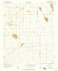
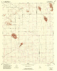
1956 Map of El Mirage
USGS Topo · Published 1957About this map
El Mirage Valley serves as the focal point of this mid-century survey, straddling the border between Los Angeles County and San Bernardino County. The landscape is defined by its prominent volcanic and crystalline formations, including the high peaks of Black Butte and the Three Sisters. In the northern section, Moody Springs and Eller Slough provide rare water sources in an otherwise arid expanse dotted with numerous small reservoirs.
Find a feature on this map
33 named features on this map. Tap any name to fly to it.
Don’t see what you’re looking for? This feature index may not catch every label — zoom into the map to look around manually.
Map Details
Editions of this 1956 El Mirage Map
5 editions found
Other maps of this area

1901 · Southern California Sheet No. 1
USGS Topo · 1:250,000

1903 · Rock Creek
USGS Topo · 1:62,500

1903 · San Antonio
USGS Topo · 1:62,500

1904 · Southern California Sheet No. 1
USGS Topo · 1:250,000

1930 · Black Butte
USGS Topo · 1:24,000

1930 · El Mirage
USGS Topo · 1:24,000

1930 · Angle
USGS Topo · 1:24,000

1930 · Wilsona
USGS Topo · 1:24,000

1932 · Angle
USGS Topo · 1:24,000

1933 · El Mirage
USGS Topo · 1:24,000