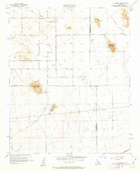
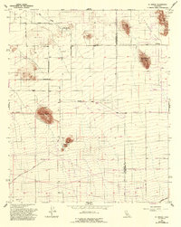
1956 Map of El Mirage
USGS Topo · Published 1963About this map
El Mirage Valley transitions from the high desert plains into a landscape marked by isolated buttes and mining prospects along the Los Angeles and San Bernardino County line. The 1950s geography of this region is defined by a sparse network of straight desert roads, including Palmdale Boulevard and El Mirage Road, connecting scattered water sources like Moody Springs. Significant geological markers and survey points dominate the terrain, notably Black Butte and the Three Sisters peaks. Aviation history is quietly noted at Gray Butte Field (Abandoned), which appears here as a relic of earlier desert operations. The presence of numerous quarries, shafts, and prospects near Mt Elmo and Black Mtn suggests a period of active mineral exploration and resource extraction in this corner of the Mojave Desert.
Find a feature on this map
27 named features on this map. Tap any name to fly to it.
Don’t see what you’re looking for? This feature index may not catch every label — zoom into the map to look around manually.
Map Details
Editions of this 1956 El Mirage Map
5 editions found
Other maps of this area

1901 · Southern California Sheet No. 1
USGS Topo · 1:250,000

1903 · Rock Creek
USGS Topo · 1:62,500

1903 · San Antonio
USGS Topo · 1:62,500

1904 · Southern California Sheet No. 1
USGS Topo · 1:250,000

1930 · Black Butte
USGS Topo · 1:24,000

1930 · El Mirage
USGS Topo · 1:24,000

1930 · Angle
USGS Topo · 1:24,000

1930 · Wilsona
USGS Topo · 1:24,000

1932 · Angle
USGS Topo · 1:24,000

1933 · El Mirage
USGS Topo · 1:24,000