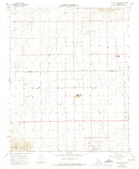
1965 Map of Little Buttes
USGS Topo · Published 1975About this map
Antelope Acres sits at the southern edge of this mid-century desert landscape, where a rigid grid of roads including Avenue A and Avenue E cuts across the arid terrain. The map records the early development of the western Antelope Valley, notably marked by the Willow Springs Raceway in the northeast and the isolated Rogers School to the east.
Find a feature on this map
19 named features on this map. Tap any name to fly to it.
Don’t see what you’re looking for? This feature index may not catch every label — zoom into the map to look around manually.
Map Details
Editions of this 1965 Little Buttes Map
2 editions found
Other maps of this area

1915 · Elizabeth Lake
USGS Topo · 1:125,000

1917 · Elizabeth Lake
USGS Topo · 1:125,000

1931 · Little Buttes
USGS Topo · 1:24,000

1931 · Esperanza School
USGS Topo · 1:24,000

1934 · Little Buttes
USGS Topo · 1:24,000

1934 · Esperanza School
USGS Topo · 1:24,000

1943 · Rosamond
USGS Topo · 1:62,500

1943 · Willow Springs
USGS Topo · 1:62,500
1947 · Rosamond
USGS Topo · 1:24,000

1947 · Soledad Mountain
USGS Topo · 1:24,000