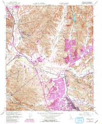
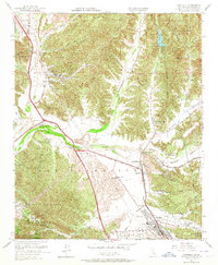
1952 Map of Newhall
USGS Topo · Published 1988About this map
The Santa Clara River valley serves as the central corridor for this 1952 study, showing the convergence of the Southern Pacific railroad and early highway infrastructure in northern Los Angeles County. This era captures the transition of the region from a series of scattered ranches and rail stops into the beginnings of suburban expansion. Major landmarks like the Waysid Honor Rancho and the Dry Canyon Res are clearly defined, alongside the established communities of Saugus and Newhall.
Find a feature on this map
53 named features on this map. Tap any name to fly to it.
Don’t see what you’re looking for? This feature index may not catch every label — zoom into the map to look around manually.
Map Details
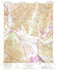
Editions of this 1952 Newhall Map
6 editions found
Other maps of this area

1900 · Fernando
USGS Topo · 1:62,500

1901 · Southern California Sheet No. 1
USGS Topo · 1:250,000

1903 · Tejon
USGS Topo · 1:125,000

1903 · Camulos
USGS Topo · 1:125,000

1903 · Santa Susana
USGS Topo · 1:62,500

1904 · Southern California Sheet No. 1
USGS Topo · 1:250,000

1915 · Elizabeth Lake
USGS Topo · 1:125,000

1917 · Elizabeth Lake
USGS Topo · 1:125,000

1925 · Sylmar
USGS Topo · 1:24,000

1928 · Sylmar
USGS Topo · 1:24,000
Featured Places
- Santa Clarita, CA
- Sulphur Springs, CA
- Pardee, Santa Clarita
- Rancho Santa Clarita, Santa Clarita
- Castaic, CA