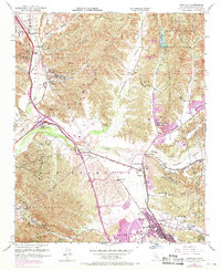
1952 Map of Newhall
USGS Topo · Published 1970About this map
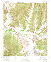
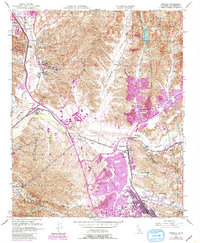
Rancho San Francisco land grants and the Southern Pacific railroad define the early development of this Santa Clarita Valley corridor. The map illustrates a transitional landscape where historic ranching boundaries intersect with mid-century suburban expansion, particularly around Newhall and Saugus. Notable institutional and agricultural landmarks include the Wayside Honor Rancho and Newhall Ranch, while the local education system is represented by the Saugus School and Hart School. The confluence of the Santa Clara River and its tributaries, such as San Francisquito Canyon and Soledad Canyon, highlights the area's topographical dependence on the drainage patterns of the surrounding Santa Susana Mountains and Angelles National Forest. Extensive oil wells scattered throughout the canyons and along the Golden State Freeway reveal the vital role of petroleum extraction in the local economy during this era.
Find a feature on this map
52 named features on this map. Tap any name to fly to it.
Don’t see what you’re looking for? This feature index may not catch every label — zoom into the map to look around manually.
Map Details
Editions of this 1952 Newhall Map
6 editions found
Other maps of this area

1900 · Fernando
USGS Topo · 1:62,500

1901 · Southern California Sheet No. 1
USGS Topo · 1:250,000

1903 · Tejon
USGS Topo · 1:125,000

1903 · Camulos
USGS Topo · 1:125,000

1903 · Santa Susana
USGS Topo · 1:62,500

1904 · Southern California Sheet No. 1
USGS Topo · 1:250,000

1915 · Elizabeth Lake
USGS Topo · 1:125,000

1917 · Elizabeth Lake
USGS Topo · 1:125,000

1925 · Sylmar
USGS Topo · 1:24,000

1928 · Sylmar
USGS Topo · 1:24,000
Featured Places
- Santa Clarita, CA
- Sulphur Springs, CA
- Pardee, Santa Clarita
- Rancho Santa Clarita, Santa Clarita
- Castaic, CA