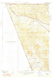
1938 Map of Gorman
USGS Topo · Published 1948About this map
The San Andreas Rift Zone creates a striking geological corridor through this portion of the Tehachapi Mountains and Tejon Pass. Surveyed in the early 1930s with late-1940s culture revisions, the map highlights a critical transportation bottleneck where the Golden State Highway and a major Transmission Line snake through the mountainous terrain. Settlement is concentrated around the community of Gorman, an essential stopover point for travelers navigating the pass between the Central Valley and Southern California.
Find a feature on this map
26 named features on this map. Tap any name to fly to it.
Don’t see what you’re looking for? This feature index may not catch every label — zoom into the map to look around manually.
Map Details
Editions of this 1938 Gorman Map
3 editions found
Other maps of this area

1903 · Tejon
USGS Topo · 1:125,000

1932 · Beartrap Canyon
USGS Topo · 1:24,000

1933 · Quail
USGS Topo · 1:24,000

1933 · Gorman
USGS Topo · 1:24,000

1938 · Beartrap Canyon
USGS Topo · 1:24,000

1938 · Gorman
USGS Topo · 1:24,000

1938 · Black Mountain
USGS Topo · 1:24,000

1938 · Quail
USGS Topo · 1:24,000

1942 · Frazier Mountain
USGS Topo · 1:24,000
1944 · Frazier Mountain
USGS Topo · 1:31,680