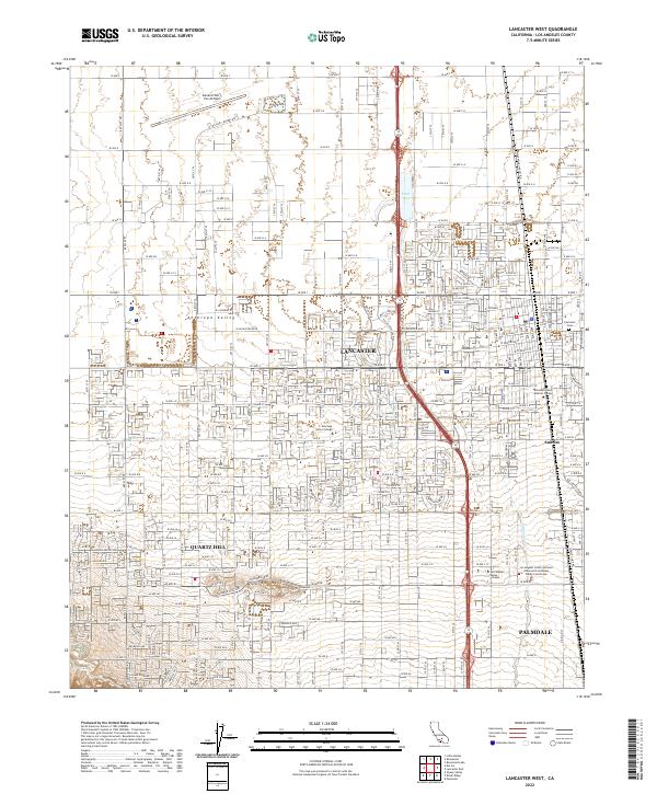
2022 Map of Lancaster West
USGS Topo · Published 2022About this map
Antelope Valley hosts a dense network of residential and civic development at the interface of the high desert and the growing urban edge of Los Angeles County. The city of Lancaster serves as a primary hub, marked by institutional anchors like the Michael Antonovich Antelope Valley Courthouse and the Lancaster Cem. Transportation and aviation define the local economy, with the General Wm J Fox Airfield positioned in the north and the thoroughfares of Palmdale to the south.
Find a feature on this map
120 named features on this map. Tap any name to fly to it.
Don’t see what you’re looking for? This feature index may not catch every label — zoom into the map to look around manually.
Map Details
Editions of this 2022 Lancaster West Map
This is the sole edition of this map. No revisions or reprints were ever made.
Other maps of this area

1915 · Elizabeth Lake
USGS Topo · 1:125,000

1917 · Elizabeth Lake
USGS Topo · 1:125,000

1930 · Oban
USGS Topo · 1:24,000

1930 · Lancaster
USGS Topo · 1:24,000

1931 · Del Sur
USGS Topo · 1:24,000

1931 · Esperanza School
USGS Topo · 1:24,000

1933 · Lancaster
USGS Topo · 1:24,000

1933 · Oban
USGS Topo · 1:24,000

1934 · Esperanza School
USGS Topo · 1:24,000
1936 · Del Sur
USGS Topo · 1:24,000