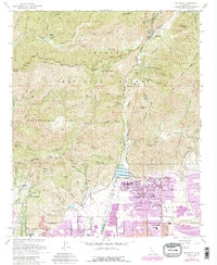
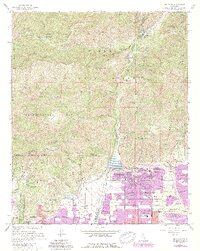
1967 Map of Mt. Baldy
USGS Topo · Published 1988About this map
San Dimas Experimental Forest and the Sheep Mountain Wilderness dominate this landscape, illustrating the critical mid-century management of California's watersheds and wildlands. The transition from the high peaks of the Angeles National Forest to the urbanizing valleys below is captured through a network of canyons, including San Dimas Canyon and San Antonio Creek. While much of the terrain remains protected forest, the southern edge shows the growth of Upland and Claremont during the late 1960s.
Find a feature on this map
67 named features on this map. Tap any name to fly to it.
Don’t see what you’re looking for? This feature index may not catch every label — zoom into the map to look around manually.
Map Details
Editions of this 1967 Mt. Baldy Map
5 editions found
Other maps of this area

1894 · Pomona
USGS Topo · 1:62,500

1897 · Pomona
USGS Topo · 1:62,500

1897 · Cucamonga
USGS Topo · 1:62,500

1898 · Pomona
USGS Topo · 1:62,500

1900 · Cucamonga
USGS Topo · 1:62,500

1901 · Southern California Sheet No. 1
USGS Topo · 1:250,000

1903 · Rock Creek
USGS Topo · 1:62,500

1903 · Cucamonga
USGS Topo · 1:62,500

1903 · San Antonio
USGS Topo · 1:62,500

1904 · Pomona
USGS Topo · 1:62,500