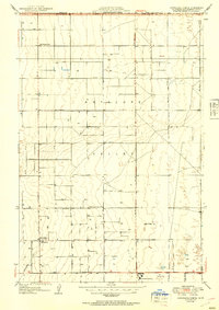
1951 Map of Esperanza School
USGS Topo · Published 1951About this map
Antelope Valley's high desert landscape is defined here by a geometric grid of rural roads and scattered educational sites during the mid-century period. The survey, which includes culture revisions by Los Angeles County, reveals a sparse but established settlement pattern where water is a critical resource, evidenced by numerous Wells dotting the landscape. Several historic schools serve the region, including the Old Esperanza Sch, Old Rogers Sch, and the more modern West Side Union Sch, reflecting the shifting centers of community life as the valley developed.
Find a feature on this map
12 named features on this map. Tap any name to fly to it.
Don’t see what you’re looking for? This feature index may not catch every label — zoom into the map to look around manually.
Map Details
Editions of this 1951 Esperanza School Map
2 editions found
Other maps of this area

1915 · Elizabeth Lake
USGS Topo · 1:125,000

1917 · Elizabeth Lake
USGS Topo · 1:125,000

1930 · Oban
USGS Topo · 1:24,000

1930 · Lancaster
USGS Topo · 1:24,000

1931 · Little Buttes
USGS Topo · 1:24,000

1931 · Del Sur
USGS Topo · 1:24,000

1931 · Esperanza School
USGS Topo · 1:24,000

1932 · Lake
USGS Topo · 1:24,000

1933 · Lancaster
USGS Topo · 1:24,000

1933 · Oban
USGS Topo · 1:24,000