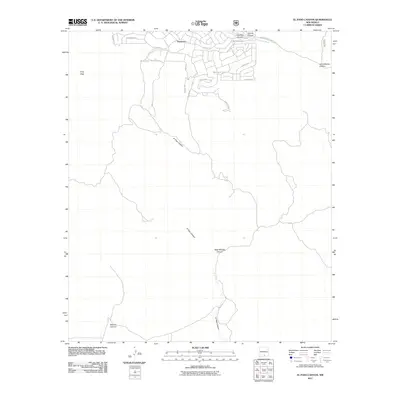
2011 Map of El Paso Canyon
USGS Topo · Published 2011About this map
Timberon occupies the northern portion of this landscape, where a dense network of mountain roads like Pioneer Dr and Sacramento Dr serves the local community. The terrain is defined by deep drainages and high points, including Culp Peak to the west. Water management in this arid environment is evidenced by the presence of Rim Tank and Womack Tank, positioned near the upper reaches of the canyons. Moving south, the map is dominated by the namesake El Paso Canyon, which winds through the territory alongside West McAfee Canyon and Wildcat Canyon. These canyons eventually converge toward the lower elevations, while the Sacramento River flows along the northeastern boundary near Arkansas Canyon. The transition from the residential planning of the north to the rugged, unnamed southern expanses illustrates the intentional settlement patterns in Otero County during the early 21st century.
Find a feature on this map
27 named features on this map. Tap any name to fly to it.
Don’t see what you’re looking for? This feature index may not catch every label — zoom into the map to look around manually.
Map Details
Editions of this 2011 El Paso Canyon Map
This is the sole edition of this map. No revisions or reprints were ever made.
Other maps of this area

1943 · Pendejo Wash
USGS Topo · 1:62,500

1950 · Escondido Canyon
USGS Topo · 1:62,500

1954 · Carlsbad
USGS Topo · 1:250,000

1958 · Carlsbad
USGS Topo · 1:250,000

1965 · Bear Spring
USGS Topo · 1:24,000

1965 · Surveyors Canyon
USGS Topo · 1:24,000

1965 · Rogers Ruins
USGS Topo · 1:24,000

1965 · El Paso Canyon
USGS Topo · 1:24,000

1979 · Alamogordo
USGS Topo · 1:100,000

1979 · Crow Flats
USGS Topo · 1:100,000