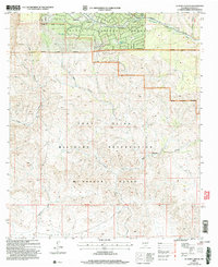
2004 Map of El Paso Canyon
USGS Topo · Published 2006About this map
Lincoln National Forest land meets the sprawling northern expanse of the Fort Bliss Military Reservation in this high-altitude borderland. The settlement of Timberon sits tucked into the northern edge of the map, serving as a gateway between the forested peaks and the high desert terrain to the south. The landscape is defined by its dramatic drainage systems, including the Sacramento River and a series of deep cuts such as El Paso Canyon and Culp Canyon.
Find a feature on this map
23 named features on this map. Tap any name to fly to it.
Don’t see what you’re looking for? This feature index may not catch every label — zoom into the map to look around manually.
Map Details
Editions of this 2004 El Paso Canyon Map
This is the sole edition of this map. No revisions or reprints were ever made.
Other maps of this area

1943 · Pendejo Wash
USGS Topo · 1:62,500

1950 · Escondido Canyon
USGS Topo · 1:62,500

1954 · Carlsbad
USGS Topo · 1:250,000

1958 · Carlsbad
USGS Topo · 1:250,000

1965 · Bear Spring
USGS Topo · 1:24,000

1965 · Surveyors Canyon
USGS Topo · 1:24,000

1965 · Rogers Ruins
USGS Topo · 1:24,000

1965 · El Paso Canyon
USGS Topo · 1:24,000

1979 · Alamogordo
USGS Topo · 1:100,000

1979 · Crow Flats
USGS Topo · 1:100,000