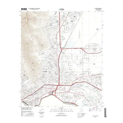
2016 Map of El Paso
USGS Topo · Published 2016About this map
The international boundary along the Rio Grande defines the southern edge of this West Texas landscape, where the Chamizal National Memorial stands as a significant landmark of diplomatic history. To the north, the sharp rise of Mt Franklin and Sugarloaf Mtn provides a dramatic backdrop to the expanding urban grid of El Paso. The map captures the dense residential and industrial development of neighborhoods like Sunrise Acres, Mission Hills, and Cielo Vista, alongside large-scale infrastructure such as Biggs Army Airfield (Fort Bliss) and the El Paso International Airport. For those researching local heritage, the inclusion of the large Concordia Cem and Evergreen Cem provides critical points for genealogical study. The transition from the high desert peaks of Ranger Peak and Comanche Peak to the river valley floor illustrates the geography that has long shaped this border community.
Find a feature on this map
56 named features on this map. Tap any name to fly to it.
Don’t see what you’re looking for? This feature index may not catch every label — zoom into the map to look around manually.
Map Details
Editions of this 2016 El Paso Map
This is the sole edition of this map. No revisions or reprints were ever made.
Other maps of this area

1896 · El Paso
USGS Topo · 1:125,000

1908 · El Paso
USGS Topo · 1:125,000

1917 · Canutillo
USGS Topo · 1:62,500

1919 · Canutillo
USGS Topo · 1:62,500

1939 · Ysleta
USGS Topo · 1:62,500

1941 · El Paso
USGS Topo · 1:31,680

1941 · Ysleta
USGS Topo · 1:62,500

1942 · Fort Bliss
USGS Topo · 1:62,500

1943 · El Paso
USGS Topo · 1:31,680

1945 · Ysleta
USGS Topo · 1:62,500