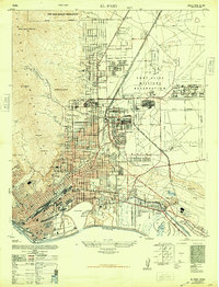
1948 Map of El Paso
USGS Topo · Published 1948About this map
Fort Bliss Military Reservation dominates the eastern half of this border landscape, showcasing an extensive network of barracks, airfields like Biggs Field, and specialized installations including a skeet range and Ordnance Igloo. The city's residential growth is visible in established neighborhoods such as Kern Place and Morningside, while the educational infrastructure is highlighted by Austin High School and several local primary schools. Along the river, Cordova Island remains a notable geographic anomaly before the final channelization of the Rio Grande.
Find a feature on this map
59 named features on this map. Tap any name to fly to it.
Don’t see what you’re looking for? This feature index may not catch every label — zoom into the map to look around manually.
Map Details
Editions of this 1948 El Paso Map
This is the sole edition of this map. No revisions or reprints were ever made.
Other maps of this area

1896 · El Paso
USGS Topo · 1:125,000

1908 · El Paso
USGS Topo · 1:125,000

1917 · Canutillo
USGS Topo · 1:62,500

1919 · Canutillo
USGS Topo · 1:62,500

1939 · Ysleta
USGS Topo · 1:62,500

1941 · El Paso
USGS Topo · 1:31,680

1941 · Ysleta
USGS Topo · 1:62,500

1942 · Fort Bliss
USGS Topo · 1:62,500

1943 · El Paso
USGS Topo · 1:31,680

1945 · Ysleta
USGS Topo · 1:62,500