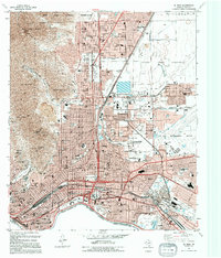
1994 Map of El Paso
USGS Topo · Published 1994About this map
The Rio Grande Rio Bravo forms the international boundary in this 1990s survey, anchoring the city of El Paso against the rugged peaks of the Franklin Mountains State Park. The landscape is dominated by the sprawling Fort Bliss Military Reservation, which includes Biggs Army Airfield and the Fort Bliss National Cemetery. The urban grid reflects decades of growth, from the historic core near Concordia Cemetery to the commercial development around Cielo Vista Mall. Along the river, the Chamizal National Memorial stands as a testament to the Chamizal Convention Bdy, marking a significant diplomatic resolution of the border. Transport and industry are central to the area's character, evidenced by the Southern Pacific railroad lines and the El Paso International Airport infrastructure.
Find a feature on this map
95 named features on this map. Tap any name to fly to it.
Don’t see what you’re looking for? This feature index may not catch every label — zoom into the map to look around manually.
Map Details
Editions of this 1994 El Paso Map
This is the sole edition of this map. No revisions or reprints were ever made.
Other maps of this area

1896 · El Paso
USGS Topo · 1:125,000

1908 · El Paso
USGS Topo · 1:125,000

1917 · Canutillo
USGS Topo · 1:62,500

1919 · Canutillo
USGS Topo · 1:62,500

1939 · Ysleta
USGS Topo · 1:62,500

1941 · El Paso
USGS Topo · 1:31,680

1941 · Ysleta
USGS Topo · 1:62,500

1942 · Fort Bliss
USGS Topo · 1:62,500

1943 · El Paso
USGS Topo · 1:31,680

1945 · Ysleta
USGS Topo · 1:62,500